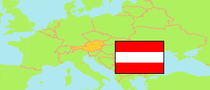
Austria: Tamsweg District
Communes
The population of the communes in Tamsweg District according to census results and official estimates.
| Name | Status | Population Census 2001-05-15 | Population Census 2011-10-31 | Population Estimate 2023-01-01 | |
|---|---|---|---|---|---|
| Göriach | Commune | 371 | 364 | 345 | → |
| Lessach | Commune | 575 | 559 | 547 | → |
| Mariapfarr | Commune | 2,213 | 2,381 | 2,475 | → |
| Mauterndorf | Commune | 1,850 | 1,688 | 1,609 | → |
| Muhr | Commune | 631 | 565 | 489 | → |
| Ramingstein | Commune | 1,388 | 1,168 | 1,040 | → |
| Sankt Andrä im Lungau | Commune | 738 | 750 | 748 | → |
| Sankt Margarethen im Lungau | Commune | 771 | 763 | 761 | → |
| Sankt Michael im Lungau | Commune | 3,590 | 3,513 | 3,539 | → |
| Tamsweg | Commune | 5,936 | 5,628 | 5,757 | → |
| Thomatal | Commune | 341 | 344 | 356 | → |
| Tweng | Commune | 310 | 280 | 239 | → |
| Unternberg | Commune | 984 | 999 | 1,043 | → |
| Weißpriach | Commune | 334 | 316 | 307 | → |
| Zederhaus | Commune | 1,250 | 1,184 | 1,182 | → |
Contents: Localities
All localities with a population of at least 20 according to census results and latest official estimates.
| Name | Status | Commune | Population Census 2001-05-15 | Population Census 2011-10-31 | Population Estimate 2023-01-01 | |
|---|---|---|---|---|---|---|
| Bundschuh | Locality | Thomatal | 38 | 40 | 35 | → |
| Faningberg | Locality | Mauterndorf | 82 | 64 | 59 | → |
| Göriach | Locality and Commune | Göriach | 371 | 364 | 345 | → |
| Haiden | Locality | Tamsweg | 281 | 246 | 243 | → |
| Hintermuhr | Locality | Muhr | 109 | 106 | 82 | → |
| Höf | Locality | Sankt Michael im Lungau | 255 | 267 | 265 | → |
| Keusching | Locality | Tamsweg | 51 | 44 | 46 | → |
| Lasaberg | Locality | Tamsweg | 204 | 184 | 167 | → |
| Lessach | Locality | Lessach | 418 | 433 | 438 | → |
| Mariapfarr | Locality | Mariapfarr | 1,398 | 1,582 | 1,659 | → |
| Mauterndorf | Locality | Mauterndorf | 1,435 | 1,312 | 1,226 | → |
| Mignitz | Locality | Ramingstein | 193 | 162 | 138 | → |
| Mitterberg | Locality | Ramingstein | 533 | 407 | 348 | → |
| Mörtelsdorf | Locality | Tamsweg | 925 | 936 | 940 | → |
| Neuseß | Locality | Mauterndorf | 139 | 135 | 116 | → |
| Oberweißburg | Locality | Sankt Michael im Lungau | 393 | 327 | 301 | → |
| Pichl | Locality | Mariapfarr | 364 | 360 | 384 | → |
| Ramingstein | Locality | Ramingstein | 662 | 599 | 554 | → |
| Sankt Andrä im Lungau | Locality and Commune | Sankt Andrä im Lungau | 738 | 750 | 748 | → |
| Sankt Margarethen im Lungau | Locality and Commune | Sankt Margarethen im Lungau | 771 | 763 | 761 | → |
| Sankt Martin | Locality | Sankt Michael im Lungau | 672 | 634 | 617 | → |
| Sankt Michael im Lungau | Locality | Sankt Michael im Lungau | 2,037 | 2,059 | 2,147 | → |
| Sauerfeld | Locality | Tamsweg | 508 | 456 | 444 | → |
| Schellgaden | Locality | Muhr | 77 | 80 | 57 | → |
| Seetal | Locality | Tamsweg | 132 | 137 | 124 | → |
| Steindorf | Locality | Mauterndorf | 194 | 177 | 208 | → |
| Tamsweg | Locality | Tamsweg | 3,606 | 3,436 | 3,606 | → |
| Thomatal | Locality | Thomatal | 303 | 304 | 321 | → |
| Tweng | Locality and Commune | Tweng | 310 | 280 | 239 | → |
| Unternberg (incl. Voidersdorf) | Locality and Commune | Unternberg | 984 | 999 | 1,043 | → |
| Unterweißburg | Locality | Sankt Michael im Lungau | 233 | 226 | 209 | → |
| Vordermuhr | Locality | Muhr | 445 | 379 | 350 | → |
| Weißpriach | Locality and Commune | Weißpriach | 334 | 316 | 307 | → |
| Wölting | Locality | Tamsweg | 229 | 189 | 187 | → |
| Zankwarn | Locality | Mariapfarr | 451 | 439 | 432 | → |
| Zederhaus | Locality and Commune | Zederhaus | 1,250 | 1,184 | 1,182 | → |
| Zoitzach | Locality | Lessach | 157 | 126 | 109 | → |
Source: Statistik Austria.
Explanation: Localities are defined independently of the type of settlement by municipal and state laws; they may be, e.g., closed settlements, scattered settlements or combinations thereof.