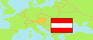
Waldzell
Commune in Ried District
Commune
The population development of Waldzell.
| Name | Status | Population Census 2001-05-15 | Population Census 2011-10-31 | Population Estimate 2022-01-01 | Population Estimate 2025-01-01 | |
|---|---|---|---|---|---|---|
| Waldzell | Commune | 2,096 | 2,086 | 2,277 | 2,299 | → |
Contents: Localities
The population development of the localities in Waldzell.
| Name | Status | Commune | Population Census 2001-05-15 | Population Census 2011-10-31 | Population Estimate 2022-01-01 | Population Estimate 2025-01-01 | |
|---|---|---|---|---|---|---|---|
| Bach | Locality | Waldzell | 61 | 79 | 72 | 72 | → |
| Baumgarten | Locality | Waldzell | 11 | 37 | 25 | 28 | → |
| Besendorf | Locality | Waldzell | 61 | 53 | 44 | 44 | → |
| Bleckenwegen | Locality | Waldzell | 47 | 35 | 43 | 38 | → |
| Brackenberg | Locality | Waldzell | 40 | 72 | 88 | 86 | → |
| Breitwies | Locality | Waldzell | 58 | 43 | 78 | 83 | → |
| Dundeck | Locality | Waldzell | 88 | 23 | 22 | 20 | → |
| Födering | Locality | Waldzell | 34 | 27 | 29 | 30 | → |
| Gitthof | Locality | Waldzell | 60 | 58 | 50 | 45 | → |
| Hacksperr | Locality | Waldzell | 82 | 79 | 77 | 73 | → |
| Hartlberg | Locality | Waldzell | 53 | 52 | 65 | 63 | → |
| Höschmühl | Locality | Waldzell | 42 | 34 | 27 | 23 | → |
| Knechtsgern | Locality | Waldzell | 51 | 49 | 59 | 55 | → |
| Kohleck | Locality | Waldzell | 50 | 60 | 76 | 77 | → |
| Maireck | Locality | Waldzell | 55 | 44 | 55 | 58 | → |
| Nußbaum am Kobernaußer Walde | Locality | Waldzell | 81 | 139 | 148 | 163 | → |
| Reith | Locality | Waldzell | 28 | 30 | 31 | 29 | → |
| Roderer | Locality | Waldzell | 35 | 35 | 47 | 51 | → |
| Schratteneck | Locality | Waldzell | 159 | 153 | 159 | 166 | → |
| Schwendt | Locality | Waldzell | 37 | 33 | 38 | 37 | → |
| Straß | Locality | Waldzell | 72 | 132 | 162 | 149 | → |
| Waldzell | Locality | Waldzell | 647 | 642 | 728 | 760 | → |
| Weißenbrunn | Locality | Waldzell | 20 | 18 | 24 | 26 | → |
| Wirglau | Locality | Waldzell | 33 | 30 | 38 | 37 | → |
| Wirmling | Locality | Waldzell | 47 | 31 | 23 | 21 | → |
Source: Statistik Austria.
Explanation: Localities are defined independently of the type of settlement by municipal and state laws; they may be, e.g., closed settlements, scattered settlements or combinations thereof.