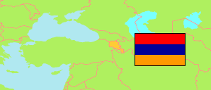
Armavir
Province in Armenia
Contents: Subdivision
The population development in Armavir as well as related information and services (Wikipedia, Google, images).
| Name | Status | Native | Population Census 2001-10-10 | Population Census 2011-10-12 | Population Census 2022-10-13 | |
|---|---|---|---|---|---|---|
| Armavir | Province | Արմավիրի մարզ | 276,233 | 265,770 | 253,493 | |
| Araks | Municipality | Արաքսի համայնք | 24,096 | 24,986 | 23,774 | → |
| Armavir | Municipality | Արմավիրի համայնք | 55,730 | 51,974 | 50,135 | → |
| Baghramyan | Municipality | Բաղրամյանի համայնք | 15,853 | 16,255 | 15,240 | → |
| Ferik | Municipality | Ֆերիկի համայնք | 399 | 310 | 349 | → |
| Khoy | Municipality | Խոյի համայնք | 28,266 | 28,975 | 26,263 | → |
| Metsamor | Municipality | Մեծամորի համայնք | 70,910 | 68,612 | 64,976 | → |
| Paraqar | Municipality | Փարաքարի համայնք | 22,143 | 24,627 | 25,310 | → |
| Vagharshapat [Ejmiatsin] | Municipality | Վաղարշապատի համայնք | 58,836 | 50,031 | 47,446 | → |
| Hayastan [Armenia] | Republic | Հայաստան | 3,213,011 | 3,018,854 | 2,932,731 |
Source: National Statistical Service of the Republic of Armenia.
Explanation: Area and density figures of municipalities and city districts are computed by using geospatial data.