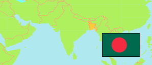
Bangladesh: Rajshahi City Corporation
Contents: Rajshahi
City Corporation
553,288 Population [2022] – census
4,648km² Area
119.0/km² Density [2022]
Contents: City Districts and Wards
The population of the city districts (thanas) and wards of Rajshahi city corporation according to the last census.
Source: Bangladesh Bureau of Statistics.
Explanation: Area figures are calculated using geospatial data.
Further information about the population structure:
| Gender (C 2022) | |
|---|---|
| Males | 284,818 |
| Females | 268,423 |
| Hijra | 47 |
| Age Groups (C 2022) | |
|---|---|
| 0-14 years | 116,610 |
| 15-64 years | 411,609 |
| 65+ years | 25,022 |
| Age Distribution (C 2022) | |
|---|---|
| 0-9 years | 73,399 |
| 10-19 years | 104,636 |
| 20-29 years | 131,589 |
| 30-39 years | 86,423 |
| 40-49 years | 67,302 |
| 50-59 years | 48,015 |
| 60-69 years | 28,375 |
| 70-79 years | 10,069 |
| 80+ years | 1,947 |
| Urbanization (C 2022) | |
|---|---|
| Urban | 553,288 |
| Religion (C 2022) | |
|---|---|
| Muslims | 520,924 |
| Hindus | 29,176 |
| Buddhists | 109 |
| Christians | 2,825 |
| Other Religion | 207 |