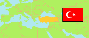
Ataşehir
District in Greater İstanbul
Contents: Subdivision
The population development in Ataşehir as well as related information and services (Wikipedia, Google, images).
| Name | Status | Population Estimate 2013-12-31 | Population Estimate 2017-12-31 | Population Estimate 2022-12-31 | |
|---|---|---|---|---|---|
| Ataşehir | District | 405,974 | 423,372 | 423,127 | |
| Aşıkveysel | Neighborhood | ... | 13,225 | 13,281 | → |
| Atatürk | Neighborhood | 27,327 | 30,063 | 33,261 | → |
| Barbaros | Neighborhood | 30,316 | 32,487 | 31,724 | → |
| Esatpaşa | Neighborhood | 24,943 | 26,866 | 33,123 | → |
| Ferhatpaşa | Neighborhood | 21,957 | 22,254 | 21,008 | → |
| Fetih | Neighborhood | 11,865 | 12,218 | 11,871 | → |
| İçerenköy | Neighborhood | 75,923 | 76,344 | 72,899 | → |
| İnönü | Neighborhood | 26,930 | 28,456 | 28,583 | → |
| Kayışdağı | Neighborhood | 39,881 | 41,757 | 43,384 | → |
| Küçükbakkalköy | Neighborhood | 27,152 | 29,032 | 30,050 | → |
| Mevlana | Neighborhood | 19,169 | 18,832 | 17,997 | → |
| Mimar Sinan | Neighborhood | 10,405 | 10,637 | 9,902 | → |
| Mustafa Kemal | Neighborhood | 14,741 | 15,033 | 14,309 | → |
| Örnek | Neighborhood | 24,028 | 27,615 | 27,837 | → |
| Yeni Çamlıca | Neighborhood | 14,625 | 14,109 | 13,085 | → |
| Yenisahra | Neighborhood | 11,755 | 11,428 | 9,968 | → |
| Yenişehir | Neighborhood | 12,243 | 13,016 | 10,845 | → |
| İstanbul | Greater Area | 15,733,590 | 16,805,684 | 17,874,473 |
Source: State Institute of Statistics, Republic of Türkiye.
Explanation: Area figures are computed by using geospatial data.