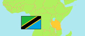
Busekelo
District in Southern Highlands
Contents: Subdivision
The population in Busekelo as well as related information and services (Wikipedia, Google, images).
| Name | Status | Population Census 2022-08-23 | |
|---|---|---|---|
| Busekelo (← Rungwe) | District | 100,123 | |
| Isange | Rural Ward | 5,587 | → |
| Itete | Rural Ward | 10,513 | → |
| Kabula | Rural Ward | 6,368 | → |
| Kambasegela | Rural Ward | 6,746 | → |
| Kandete | Rural Ward | 11,443 | → |
| Kisegese | Rural Ward | 6,474 | → |
| Lufilyo | Rural Ward | 6,534 | → |
| Lupata | Rural Ward | 8,552 | → |
| Luteba | Rural Ward | 7,413 | → |
| Lwangwa | Rural Ward | 11,134 | → |
| Mpata | Rural Ward | 3,511 | → |
| Mpombo | Rural Ward | 8,428 | → |
| Ntaba | Rural Ward | 7,420 | → |
| Southern Highlands | Zone | 10,313,386 |
Source: National Bureau of Statistics Tanzania.
Explanation: Area figures are derived from geospatial data.