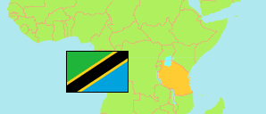
Rombo
District in Northern Tanzania
Contents: Subdivision
The population in Rombo as well as related information and services (Wikipedia, Google, images).
| Name | Status | Population Census 2022-08-23 | |
|---|---|---|---|
| Rombo | District | 275,314 | |
| Chala | Rural Ward | 5,856 | → |
| Holili | Mixed Ward | 10,932 | → |
| Katangara Mrere | Rural Ward | 10,912 | → |
| Kelamfua Mokala | Mixed Ward | 13,945 | → |
| Keni Aleni | Rural Ward | 10,178 | → |
| Keni Mengeni | Rural Ward | 8,567 | → |
| Kirongo Samanga | Rural Ward | 15,327 | → |
| Kirwa Keni | Rural Ward | 7,330 | → |
| Kisale Masangara | Rural Ward | 9,481 | → |
| Kitirima | Rural Ward | 12,751 | → |
| Kitirima Kingachi | Rural Ward | 8,266 | → |
| Mahida | Rural Ward | 8,488 | → |
| Makiidi | Rural Ward | 8,735 | → |
| Mamsera | Rural Ward | 4,836 | → |
| Manda | Rural Ward | 3,634 | → |
| Marangu Kitowo | Rural Ward | 7,539 | → |
| Mengwe | Rural Ward | 4,771 | → |
| Motamburu Kitendeni | Rural Ward | 4,793 | → |
| Mrao Keryo | Rural Ward | 7,127 | → |
| Nanjala | Rural Ward | 21,881 | → |
| Ngoyoni | Rural Ward | 4,042 | → |
| Olele | Rural Ward | 6,256 | → |
| Reha | Rural Ward | 7,898 | → |
| Shimbi | Rural Ward | 5,502 | → |
| Shimbi Kwandele | Rural Ward | 9,435 | → |
| Tarakea Motamburu | Mixed Ward | 27,019 | → |
| Ubetu Kahe | Rural Ward | 20,954 | → |
| Ushiri Ikuini | Rural Ward | 8,859 | → |
| Northern | Zone | 8,726,288 |
Source: National Bureau of Statistics Tanzania.
Explanation: Area figures are derived from geospatial data.