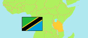
Longido
District in Northern Tanzania
Contents: Subdivision
The population in Longido as well as related information and services (Wikipedia, Google, images).
| Name | Status | Population Census 2022-08-23 | |
|---|---|---|---|
| Longido | District | 175,915 | |
| Eleng'ata Dapash | Rural Ward | 6,528 | → |
| Engarenaibor | Rural Ward | 15,227 | → |
| Engikaret | Rural Ward | 8,298 | → |
| Gelai Lumbwa | Rural Ward | 9,932 | → |
| Gelai Meirugoi | Rural Ward | 12,474 | → |
| Ilorienito | Rural Ward | 6,932 | → |
| Kamwanga | Rural Ward | 13,053 | → |
| Kimokouwa | Rural Ward | 14,435 | → |
| Kitumbeine (Kitumbeine) | Rural Ward | 10,203 | → |
| Longido | Mixed Ward | 3,948 | → |
| Matale | Rural Ward | 8,340 | → |
| Mundarara | Rural Ward | 11,442 | → |
| Namanga | Mixed Ward | 12,340 | → |
| Noondoto | Rural Ward | 5,808 | → |
| Olmolog | Rural Ward | 12,536 | → |
| Orbomba | Rural Ward | 11,060 | → |
| Sinya | Rural Ward | 5,097 | → |
| Tingatinga | Rural Ward | 8,262 | → |
| Northern | Zone | 8,726,288 |
Source: National Bureau of Statistics Tanzania.
Explanation: Area figures are derived from geospatial data.