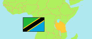
Mkuranga
District in Coastal Tanzania
Contents: Subdivision
The population in Mkuranga as well as related information and services (Wikipedia, Google, images).
| Name | Status | Population Census 2022-08-23 | |
|---|---|---|---|
| Mkuranga | District | 533,033 | |
| Beta | Rural Ward | 7,515 | → |
| Bupu | Rural Ward | 8,046 | → |
| Dondo | Rural Ward | 6,204 | → |
| Kimanzichana | Mixed Ward | 23,519 | → |
| Kiparang'anda | Rural Ward | 14,153 | → |
| Kisegese | Rural Ward | 10,878 | → |
| Kisiju | Rural Ward | 8,101 | → |
| Kitomondo | Rural Ward | 5,746 | → |
| Lukanga | Rural Ward | 12,754 | → |
| Magawa | Rural Ward | 5,225 | → |
| Mbezi | Rural Ward | 8,215 | → |
| Mipeko | Rural Ward | 25,167 | → |
| Mkamba | Rural Ward | 11,888 | → |
| Mkuranga | Mixed Ward | 46,867 | → |
| Msonga | Rural Ward | 3,482 | → |
| Mwalusembe (Mwarusembe) | Mixed Ward | 16,815 | → |
| Mwandege | Mixed Ward | 67,866 | → |
| Njia Nne | Rural Ward | 4,902 | → |
| Nyamato | Rural Ward | 15,111 | → |
| Panzuo | Rural Ward | 10,281 | → |
| Shungubweni | Rural Ward | 3,796 | → |
| Tambani | Rural Ward | 60,904 | → |
| Tengelea | Rural Ward | 13,649 | → |
| Vianzi | Mixed Ward | 23,739 | → |
| Vikindu | Mixed Ward | 118,210 | → |
| Coastal | Zone | 13,434,754 |
Source: National Bureau of Statistics Tanzania.
Explanation: Area figures are derived from geospatial data.