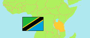
Mkalama
District in Central Tanzania
Contents: Subdivision
The population in Mkalama as well as related information and services (Wikipedia, Google, images).
| Name | Status | Population Census 2022-08-23 | |
|---|---|---|---|
| Mkalama | District | 255,514 | |
| Gumanga | Rural Ward | 14,646 | → |
| Ibaga | Mixed Ward | 15,056 | → |
| Iguguno | Mixed Ward | 19,132 | → |
| Ilunda | Rural Ward | 14,764 | → |
| Kikhonda | Rural Ward | 10,551 | → |
| Kinampundu | Rural Ward | 13,865 | → |
| Kinyangiri | Rural Ward | 18,344 | → |
| Matongo | Rural Ward | 7,831 | → |
| Miganga | Rural Ward | 9,941 | → |
| Mpambala | Rural Ward | 14,574 | → |
| Msingi | Rural Ward | 9,431 | → |
| Mwanga | Rural Ward | 22,773 | → |
| Mwangeza | Rural Ward | 32,520 | → |
| Nduguti | Mixed Ward | 12,821 | → |
| Nkalakala | Rural Ward | 11,029 | → |
| Nkinto | Rural Ward | 15,012 | → |
| Tumuli | Rural Ward | 13,224 | → |
| Central | Zone | 8,485,362 |
Source: National Bureau of Statistics Tanzania.
Explanation: Area figures are derived from geospatial data.