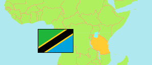
Kongwa
District in Central Tanzania
Contents: Subdivision
The population in Kongwa as well as related information and services (Wikipedia, Google, images).
| Name | Status | Population Census 2022-08-23 | |
|---|---|---|---|
| Kongwa | District | 443,867 | |
| Chamkoroma | Mixed Ward | 18,990 | → |
| Chitego | Rural Ward | 15,434 | → |
| Chiwe | Rural Ward | 30,099 | → |
| Hogoro | Rural Ward | 22,777 | → |
| Iduo | Rural Ward | 15,244 | → |
| Kibaigwa | Mixed Ward | 50,054 | → |
| Kongwa | Mixed Ward | 15,351 | → |
| Lenjulu | Rural Ward | 28,622 | → |
| Makawa | Rural Ward | 11,631 | → |
| Matongoro | Rural Ward | 11,513 | → |
| Mkoka | Mixed Ward | 16,329 | → |
| Mlali | Mixed Ward | 28,218 | → |
| Mtanana | Rural Ward | 16,435 | → |
| Nghumbi | Rural Ward | 15,778 | → |
| Ngomai | Mixed Ward | 14,319 | → |
| Njoge | Rural Ward | 10,757 | → |
| Pandambili | Mixed Ward | 13,079 | → |
| Sagara | Rural Ward | 28,536 | → |
| Sejeli | Mixed Ward | 27,312 | → |
| Songambele | Mixed Ward | 23,342 | → |
| Ugogoni | Mixed Ward | 22,621 | → |
| Zoissa | Rural Ward | 7,426 | → |
| Central | Zone | 8,485,362 |
Source: National Bureau of Statistics Tanzania.
Explanation: Area figures are derived from geospatial data.