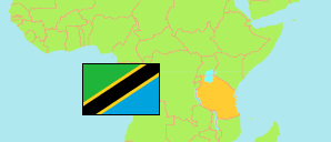
Mpwapwa
District in Central Tanzania
Contents: Subdivision
The population in Mpwapwa as well as related information and services (Wikipedia, Google, images).
| Name | Status | Population Census 2022-08-23 | |
|---|---|---|---|
| Mpwapwa | District | 403,247 | |
| Berege | Rural Ward | 12,668 | → |
| Chipogoro | Rural Ward | 14,515 | → |
| Chitemo | Rural Ward | 13,876 | → |
| Chunyu | Rural Ward | 19,190 | → |
| Galigali | Rural Ward | 5,006 | → |
| Godegode | Mixed Ward | 11,150 | → |
| Gulwe | Rural Ward | 13,189 | → |
| Ipera | Rural Ward | 9,658 | → |
| Iwondo | Rural Ward | 13,211 | → |
| Kibakwe | Mixed Ward | 19,968 | → |
| Kimagai | Rural Ward | 9,777 | → |
| Kingiti | Rural Ward | 9,213 | → |
| Lufu | Rural Ward | 5,326 | → |
| Luhundwa | Rural Ward | 16,424 | → |
| Lumuma | Rural Ward | 4,339 | → |
| Lupeta | Rural Ward | 9,795 | → |
| Malolo | Rural Ward | 7,449 | → |
| Mang'aliza | Rural Ward | 6,064 | → |
| Massa | Mixed Ward | 16,558 | → |
| Matomondo | Rural Ward | 11,228 | → |
| Mazae | Mixed Ward | 11,011 | → |
| Mbuga | Rural Ward | 6,745 | → |
| Mima | Rural Ward | 18,138 | → |
| Mlembule | Rural Ward | 11,335 | → |
| Mlunduzi | Rural Ward | 14,342 | → |
| Mpwapwa Mjini | Mixed Ward | 24,670 | → |
| Mtera | Mixed Ward | 14,187 | → |
| Nghambi | Rural Ward | 11,926 | → |
| Pwaga | Mixed Ward | 15,386 | → |
| Rudi | Rural Ward | 15,440 | → |
| Ving'hawe | Mixed Ward | 16,311 | → |
| Wangi | Rural Ward | 7,958 | → |
| Wotta | Rural Ward | 7,194 | → |
| Central | Zone | 8,485,362 |
Source: National Bureau of Statistics Tanzania.
Explanation: Area figures are derived from geospatial data.