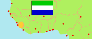
Western Area Rural
District in Sierra Leone
Contents: Subdivision
The population development in Western Area Rural as well as related information and services (Wikipedia, Google, images).
| Name | Status | Population Census 2004-12-04 | Population Census 2015-12-04 | Population Census 2021-12-09 | |
|---|---|---|---|---|---|
| Western Area Rural | District | 174,249 | 444,270 | 662,156 | |
| Koya Rural | Ward | 22,996 | 70,423 | 125,866 | → |
| Mountain Rural | Ward | 9,925 | 30,488 | 51,889 | → |
| Waterloo Rural | Ward | 77,791 | 213,778 | 314,382 | → |
| York Rural | Ward | 63,537 | 129,581 | 170,019 | → |
| Sierra Leone | Republic | 4,976,871 | 7,092,113 | 7,548,702 |
Source: Statistics Sierra Leone (web).
Explanation: Boundaries of districts and chiefdoms according to the administrative reorganization of 2017. The 2021 census is a mid-term census. The reasons for the significant differences between the 2015 and 2021 figures are unclear. Area figures are derived from geospatial data.