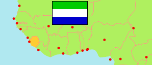
Pujehun
District in Sierra Leone
Contents: Subdivision
The population development in Pujehun as well as related information and services (Wikipedia, Google, images).
| Name | Status | Population Census 2004-12-04 | Population Census 2015-12-04 | Population Census 2021-12-09 | |
|---|---|---|---|---|---|
| Pujehun | District | 228,392 | 346,461 | 429,574 | |
| Barri | Chiefdom | 32,245 | 36,905 | 50,742 | → |
| Galliness | Chiefdom | ... | 31,381 | 28,640 | → |
| Kabonde | Chiefdom | ... | 3,569 | 5,885 | → |
| Kpaka | Chiefdom | 12,827 | 16,468 | 17,621 | → |
| Makpele | Chiefdom | 21,955 | 31,080 | 61,613 | → |
| Malen | Chiefdom | 22,090 | 49,263 | 42,654 | → |
| Mano Sakrim | Chiefdom | 7,536 | 12,893 | 15,073 | → |
| Panga | Chiefdom | ... | 45,771 | 44,325 | → |
| Panga Krim | Chiefdom | 6,651 | 8,969 | 6,737 | → |
| Pejeh | Chiefdom | 10,334 | 13,600 | 15,624 | → |
| Perri | Chiefdom | ... | 23,310 | 20,886 | → |
| Soro Gbema | Chiefdom | 31,977 | 42,292 | 76,934 | → |
| Sowa | Chiefdom | 15,402 | 17,136 | 27,308 | → |
| Yakemu Kpukumu | Chiefdom | 7,033 | 13,824 | 15,532 | → |
| Sierra Leone | Republic | 4,976,871 | 7,092,113 | 7,548,702 |
Source: Statistics Sierra Leone (web).
Explanation: Boundaries of districts and chiefdoms according to the administrative reorganization of 2017. The 2021 census is a mid-term census. The reasons for the significant differences between the 2015 and 2021 figures are unclear. Area figures are derived from geospatial data.