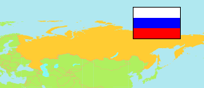
Russia: Volgograd City
Contents: City Districts
The population of the city districts of Volgograd.
| Name | Status | Native | Population Census 2002-10-09 | Population Census 2010-10-14 | Population Census 2021-10-01 | Population Estimate 2025-01-01 | |
|---|---|---|---|---|---|---|---|
| Central'nyj [Central District] | City District | Центральный район | 97,167 | 84,687 | 84,853 | 81,924 | → |
| Dzeržinskij | City District | Дзержинский район | 175,330 | 182,579 | 188,903 | 184,707 | → |
| Kirovskij | City District | Кировский район | 107,733 | 103,084 | 98,162 | 98,696 | → |
| Krasnoarmejskij | City District | Красноармейский район | 175,420 | 169,530 | 163,875 | 159,232 | → |
| Krasnooktjabr'skij | City District | Краснооктябрьский район | 155,041 | 151,780 | 146,649 | 144,512 | → |
| Sovetskij | City District | Советский район | 83,052 | 106,924 | 131,734 | 134,608 | → |
| Traktorozavodskij | City District | Тракторозаводский район | 136,746 | 139,810 | 134,223 | 130,460 | → |
| Vorošilovskij | City District | Ворошиловский район | 80,928 | 82,821 | 79,637 | 78,080 | → |
| Volgograd | City | Волгоград | 1,011,417 | 1,021,215 | 1,028,036 | 1,012,219 |
Source: Federal State Statistics Service Russia.
Explanation: The area figures of districts are computed by using geospatial data.