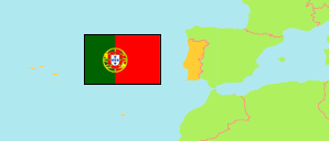
Alfândega da Fé
Municipality in Bragança District
Contents: Subdivision
The population development in Alfândega da Fé as well as related information and services (Wikipedia, Google, images).
| Name | Status | Population Census 2001-03-12 | Population Census 2011-03-21 | Population Census 2021-03-22 | |
|---|---|---|---|---|---|
| Alfândega da Fé | Municipality | 5,963 | 5,104 | 4,324 | |
| Agrobom, Saldonha e Vale Pereiro | Parish | 348 | 265 | 211 | → |
| Alfândega da Fé | Parish | 2,016 | 2,055 | 1,937 | → |
| Cerejais | Parish | 247 | 202 | 160 | → |
| Eucísia, Gouveia e Valverde | Parish | 481 | 357 | 266 | → |
| Ferradosa e Sendim da Serra | Parish | 352 | 251 | 169 | → |
| Gebelim e Soeima | Parish | 439 | 332 | 299 | → |
| Parada e Sendim da Ribeira | Parish | 303 | 216 | 208 | → |
| Pombal e Vales | Parish | 197 | 201 | 147 | → |
| Sambade | Parish | 605 | 475 | 374 | → |
| Vilar Chão | Parish | 326 | 259 | 204 | → |
| Vilarelhos | Parish | 335 | 275 | 217 | → |
| Vilares de Vilariça | Parish | 314 | 216 | 132 | → |
| Bragança | District | 148,883 | 136,252 | 122,804 |
Source: Instituto Nacional de Estatística Portugal (web).
Further information about the population structure:
| Gender (C 2021) | |
|---|---|
| Males | 2,089 |
| Females | 2,235 |
| Age Groups (C 2021) | |
|---|---|
| 0-14 years | 353 |
| 15-64 years | 2,333 |
| 65+ years | 1,638 |
| Age Distribution (C 2021) | |
|---|---|
| 80+ years | 578 |
| 70-79 years | 671 |
| 60-69 years | 778 |
| 50-59 years | 614 |
| 40-49 years | 440 |
| 30-39 years | 384 |
| 20-29 years | 353 |
| 10-19 years | 276 |
| 0-9 years | 230 |
| Citizenship (C 2021) | |
|---|---|
| Portugal | 4,227 |
| EU | 63 |
| Europe (other) | 4 |
| Africa | 6 |
| America | 15 |
| Asia & Oceania | 9 |
| Country of Birth (C 2021) | |
|---|---|
| Portugal | 4,003 |
| EU | 145 |
| Europe (other) | 22 |
| Africa | 116 |
| America | 28 |
| Asia & Oceania | 10 |