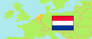
Dordrecht Industriegebied West
Municipal District in Randstad South Conurbation
Contents: Subdivision
The population in Dordrecht Industriegebied West as well as related information and services (Wikipedia, Google, images).
| Name | Status | Population Estimate 2022-01-01 | |
|---|---|---|---|
| Dordrecht Industriegebied West | Municipal District | 830 | |
| Amstelwijck | Neighborhood | 10 | → |
| Amstelwijck-West | Neighborhood | 0 | → |
| Dordtse Kil I | Neighborhood | 10 | → |
| Dordtse Kil II | Neighborhood | 5 | → |
| Dordtse Kil III | Neighborhood | 15 | → |
| Dordtse Kil IV | Neighborhood | 10 | → |
| Handelskade en 's-Gravendeelsedijk | Neighborhood | 5 | → |
| Julianahaven | Neighborhood | 10 | → |
| Krabbegors | Neighborhood | 0 | → |
| Krabbepolder | Neighborhood | 0 | → |
| Louterbloemen | Neighborhood | 10 | → |
| Oostkil | Neighborhood | 0 | → |
| Schotman terrein | Neighborhood | 30 | → |
| Tweede Tol | Neighborhood | 350 | → |
| Voltastraat en omgeving - De Put | Neighborhood | 0 | → |
| Weeskinderendijk en Dokweg | Neighborhood | 195 | → |
| Wieldrecht | Neighborhood | 180 | → |
| Wilhelminahaven | Neighborhood | 0 | → |
| Randstad Zuid (Rotterdam - Den Haag - Dordrecht - Leiden) [Randstad South] | Conurbation | 3,354,555 |
Source: Statistics Netherlands (web).
Explanation: Composition by »City Population«.