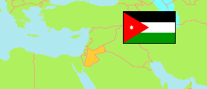
Irbid
Governorate in Jordan
Contents: Subdivision
The population development in Irbid as well as related information and services (Wikipedia, Google, images).
| Name | Status | Native | Population Census 1994-12-10 | Population Census 2004-10-02 | Population Census 2015-11-30 | |
|---|---|---|---|---|---|---|
| Irbid | Governorate | إربد | 751,634 | 928,292 | 1,770,158 | |
| Al-Āghwār ash-Shamāliyah [Aghwar Shamaliyah] | District | الأغوار الشمالية | 78,355 | 85,203 | 122,330 | → |
| Al-Kūrah [Koorah] | District | الكورة | 71,513 | 91,050 | 161,505 | → |
| Al-Mazār ash-Shamālī [Mazar Shamali] | District | المزار الشمالي | 35,651 | 44,166 | 78,427 | → |
| Al-Wasṭīyah [Wastiyyah] | District | الوسطية | ... | 24,046 | 42,571 | → |
| Ar-Ramthā [Ramtha] | District | الرمثا | 79,304 | 109,142 | 238,502 | → |
| Aṭ-Ṭaybah [Taybeh] | District | الطيبة | 23,847 | 29,132 | 51,501 | → |
| Banī Kanānah [Bani Kenanah] | District | بني كنانة | 51,868 | 76,398 | 131,797 | → |
| Banī 'Obīd [Bani Obeid] | District | بني عبيد | ... | 93,561 | 204,313 | → |
| Qaṣabah Irbid [Irbid Qasabah] | District | قصبة اربد | ... | 375,594 | 739,212 | → |
| Al-Urdunn [Jordan] | Kingdom | الأُرْدُنّ | 4,139,458 | 5,103,639 | 9,531,712 |
Source: Department of Statistics, Jordan (web).
Explanation: Area and density figures of districts are computed using geospatial data.