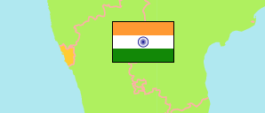
Goa was part of Portuguese India. It became (together with Damān and Diu) an Indian union territory in 1961. In 1987, Goa was separated as a state.
State
The population development of the State of Goa by census years.
| Name | Abbr. | Status | Capital | Area A (km²) | Population Census (Cf) 1991-03-01 | Population Census (Cf) 2001-03-01 | Population Census (Cf) 2011-03-01 | Population Projection (P) 2023-03-01 | |||
|---|---|---|---|---|---|---|---|---|---|---|---|
| India | IND | Rep | New Delhi | 3,166,620 | 846,387,888 | 1,028,737,436 | 1,210,854,977 | 1,387,284,900 | → | ||
| Goa | GOA | St | Panaji | 3,702 | 1,169,793 | 1,347,668 | 1,458,545 | 1,575,000 | 370200 | → |
- Office of the Registrar General and Census Commissioner.
(2023) National Commission on Population (adapted by Unique Identification Authority of India).
Major Agglomerations
| Name | Population Census (Cf) 2011-03-01 | |
|---|---|---|
| 1 | Panaji | 114,759 |
| 2 | Margao | 106,484 |
| 3 | Mormugao | 101,326 |
Contents: Agglomerations & Cities
The population development of all urban agglomerations and single cities in Goa with more than 20,000 inhabitants by census years.
| Name | Status | Population Census (Cf) 1991-03-01 | Population Census (Cf) 2001-03-01 | Population Census (Cf) 2011-03-01 | Area | ||
|---|---|---|---|---|---|---|---|
| Curchorem-Cacora | City | 18,489 | 21,407 | 22,730 | 2255 | → | |
| Mapusa (Māpuca) | City | 31,667 | 40,487 | 39,989 | 1132 | → | |
| Margao (Margão, Madgaon) | Aggl | 72,400 | 94,383 | 106,484 | 2204 | → | |
| Mormugao (Mormugão, Vasco da Gama) | Aggl | 90,429 | 104,758 | 101,326 | 3955 | → | |
| Panaji (Panjim, Pangim) | Aggl | 85,515 | 99,677 | 114,759 | 7629 | → | |
| Ponda | City | 14,661 | 17,713 | 22,664 | 522 | → | |
| Sancoale | Town | ... | 15,604 | 21,923 | 2349 | → |
- (2001) (2011) Office of the Registrar General and Census Commissioner, Delimitation Commission of India, Population Census India.
