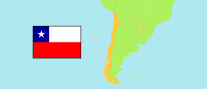
Tamarugal
Province in Chile
Contents: Subdivision
The population development in Tamarugal as well as related information and services (Wikipedia, Google, images).
| Name | Status | Population Estimate 2002-07-01 | Population Estimate 2007-07-01 | Population Estimate 2012-07-01 | Population Estimate 2017-07-01 | Population Projection 2023-07-01 | |
|---|---|---|---|---|---|---|---|
| Tamarugal | Province | 19,029 | 20,200 | 23,231 | 26,140 | 30,711 | |
| Camiña | Municipality | 1,325 | 1,222 | 1,254 | 1,286 | 1,379 | → |
| Colchane | Municipality | 1,636 | 1,484 | 1,494 | 1,500 | 1,569 | → |
| Huara | Municipality | 2,615 | 2,463 | 2,596 | 2,748 | 3,080 | → |
| Pica | Municipality | 3,620 | 4,033 | 4,717 | 5,320 | 6,231 | → |
| Pozo Almonte | Municipality | 9,833 | 10,998 | 13,170 | 15,286 | 18,452 | → |
| Chile | Republic | 15,691,701 | 16,517,933 | 17,443,491 | 18,419,192 | 19,960,889 |
Source: Instituto Nacional de Estadísticas.
Explanation: All tabulated population figures consider the results of the 2017 census.
Further information about the population structure:
| Gender (P 2023) | |
|---|---|
| Males | 15,886 |
| Females | 14,825 |
| Age Groups (P 2023) | |
|---|---|
| 0-17 years | 8,269 |
| 18-64 years | 18,521 |
| 65+ years | 3,921 |
| Age Distribution (P 2023) | |
|---|---|
| 80+ years | 821 |
| 70-79 years | 1,765 |
| 60-69 years | 2,793 |
| 50-59 years | 3,007 |
| 40-49 years | 3,782 |
| 30-39 years | 4,819 |
| 20-29 years | 4,477 |
| 10-19 years | 4,601 |
| 0-9 years | 4,646 |
| Urbanization (C 2017) | |
|---|---|
| Rural | 15,599 |
| Urban | 15,116 |
| Country of Birth (C 2017) | |
|---|---|
| Chile | 27,435 |
| South America | 3,213 |
| Central America & Caribbean | 20 |
| North America | 5 |
| Europe | 22 |
| Other country & undeclared | 20 |