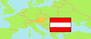
Langschlag
Commune in Zwettl District
Commune
The population development of Langschlag.
| Name | Status | Population Census 2001-05-15 | Population Census 2011-10-31 | Population Estimate 2023-01-01 | |
|---|---|---|---|---|---|
| Langschlag | Commune | 1,908 | 1,802 | 1,710 | → |
Contents: Localities
The population development of the localities in Langschlag.
| Name | Status | Commune | Population Census 2001-05-15 | Population Census 2011-10-31 | Population Estimate 2023-01-01 | |
|---|---|---|---|---|---|---|
| Bruderndorf | Locality | Langschlag | 120 | 116 | 116 | → |
| Bruderndorferwald | Locality | Langschlag | 124 | 107 | 90 | → |
| Fraberg | Locality | Langschlag | 21 | 18 | 20 | → |
| Kainrathschlag | Locality | Langschlag | 114 | 115 | 90 | → |
| Kasbach | Locality | Langschlag | 50 | 47 | 53 | → |
| Kehrbach | Locality | Langschlag | 66 | 58 | 71 | → |
| Kleinpertholz | Locality | Langschlag | 98 | 92 | 83 | → |
| Kogschlag | Locality | Langschlag | 45 | 38 | 49 | → |
| Langschlag | Locality | Langschlag | 627 | 611 | 609 | → |
| Langschlägerwald | Locality | Langschlag | 149 | 150 | 147 | → |
| Mitterschlag | Locality | Langschlag | 148 | 121 | 104 | → |
| Münzbach | Locality | Langschlag | 54 | 54 | 43 | → |
| Reichenauerwald | Locality | Langschlag | 38 | 26 | 28 | → |
| Siebenhöf | Locality | Langschlag | 95 | 93 | 80 | → |
| Stierberg | Locality | Langschlag | 53 | 61 | 48 | → |
| Streith | Locality | Langschlag | 67 | 69 | 53 | → |
Source: Statistik Austria.
Explanation: Localities are defined independently of the type of settlement by municipal and state laws; they may be, e.g., closed settlements, scattered settlements or combinations thereof.