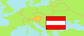
Kärnten (Austria)
State
The population development of Kärnten.
| Name | Status | Population Census 1981-05-12 | Population Census 1991-05-15 | Population Census 2001-05-15 | Population Census 2011-10-31 | Population Census 2021-10-31 | Population Estimate 2024-01-01 | |
|---|---|---|---|---|---|---|---|---|
| Kärnten [Carinthia] | State | 536,179 | 547,798 | 559,346 | 556,173 | 564,328 | 569,835 | → |
| Österreich [Austria] | Republic | 7,555,338 | 7,795,786 | 8,032,857 | 8,401,940 | 8,969,068 | 9,159,993 |
Contents: Agglomerations
The population development of the agglomerations in Kärnten.
| Name | Status | State(s) | Population Census 1981-05-12 | Population Census 1991-05-15 | Population Census 2001-05-15 | Population Census 2011-10-31 | Population Census 2021-10-31 | Population Estimate 2024-01-01 | |
|---|---|---|---|---|---|---|---|---|---|
| Klagenfurt | Agglomeration | Kärnten | 97,099 | 100,328 | 102,384 | 107,440 | 116,495 | 118,977 | → |
| Spittal an der Drau | Agglomeration | Kärnten | 20,190 | 21,019 | 22,085 | 21,886 | 21,796 | 21,990 | → |
| Villach | Agglomeration | Kärnten | 52,692 | 54,640 | 57,492 | 59,324 | 63,935 | 65,651 | → |
| Wolfsberg | Agglomeration | Kärnten | 28,097 | 27,791 | 28,446 | 27,723 | 27,606 | 27,518 | → |
Source: Statistik Austria.
Explanation: An agglomeration corresponds to the core zone of a city region according to the definition of 2001; only in case of Vienna its satellite towns are added. Agglomerations are compiled from communes in their boundaries of 2024. 2024 population figures are preliminary estimates.