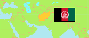
Zābul
Province in Afghanistan
Contents: Subdivision
The population in Zābul as well as related information and services (Wikipedia, Google, images).
| Name | Status | Native | Population Projection 2020-09-21 | |
|---|---|---|---|---|
| Zābul | Province | زابل | 384,349 | |
| Arghandāb | District | ارغنداب | 36,934 | → |
| Atghar | District | اتغر | 14,059 | → |
| Dāy Chōpān [Dey Chopan] | District | دای چوپان | 44,508 | → |
| Kākar [Khāk-e Afghān] | District | کاکړ / خاک افغان | 27,234 | → |
| Mīzān [Mezana] | District | میزان | 21,623 | → |
| Nowbahār [Naw Bahar] | District | نوبهار | 24,534 | → |
| Qalāt | Capital District | قلات | 44,928 | → |
| Shāh Jōy | District | شاهجوی | 79,889 | → |
| Shamulzā'yī | District | شملزائی | 36,515 | → |
| Shīnkaī [Shinkay] | District | شینکی | 31,911 | → |
| Tarneg wa Jaldak [Tarnak Aw Jaldak] | District | ترنگ و جلدک | 22,214 | → |
| Afghānestān [Afghanistan] | Islamic Republic | افغانستان | 32,890,200 |
Source: Central Statistics Office Afghanistan (web).
Explanation: The projection is based on the household listing performed from 2003 to 2005; the reliability of the figures is low. Nomades are only included in the total population of Afghanistan. Area figures of districts are computed by using geospatial data.