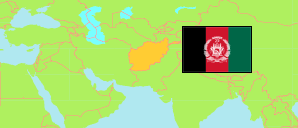
Dāykundī
Province in Afghanistan
Contents: Subdivision
The population in Dāykundī as well as related information and services (Wikipedia, Google, images).
| Name | Status | Native | Population Projection 2020-09-21 | |
|---|---|---|---|---|
| Dāykundī | Province | دایکندی | 516,504 | |
| Ishtarlay | District | اشترلی | 61,174 | → |
| Kajrān | District | کجران | 37,062 | → |
| Khadīr | District | خدیر | 53,434 | → |
| Kītī | District | کیتی | 56,436 | → |
| Mīrāmōr | District | میرامور | 86,024 | → |
| Nīlī | Capital District | نیلی | 42,832 | → |
| Pātū [Patoo; ← Gīzāb] | Temporary District | پاتو | 39,759 | → |
| Sang-e Takht [Sangi Takht] | District | سنگ تخت | 59,043 | → |
| Shahristān | District | شهرستان | 80,740 | → |
| Afghānestān [Afghanistan] | Islamic Republic | افغانستان | 32,890,200 |
Source: Central Statistics Office Afghanistan (web).
Explanation: The projection is based on the household listing performed from 2003 to 2005; the reliability of the figures is low. Nomades are only included in the total population of Afghanistan. Area figures of districts are computed by using geospatial data.