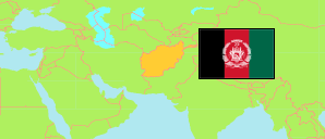
Paktiyā
Province in Afghanistan
Contents: Subdivision
The population in Paktiyā as well as related information and services (Wikipedia, Google, images).
| Name | Status | Native | Population Projection 2020-09-21 | |
|---|---|---|---|---|
| Paktiyā [Paktia] | Province | پکتیا | 611,952 | |
| Aḥmad'ābād [Ahmad Aba] | District | احمدآباد | 31,488 | → |
| Chamkanī [Tsamkani] | District | چمکنی | 56,465 | → |
| Dand Patān [Dand Aw Patan] | District | دند پتان | 30,027 | → |
| Gardah Siray [Garda Siray; ← Zadrān] | Temporary District | گرده څېړی | 12,642 | → |
| Gardēz | Capital District | گردیز | 95,663 | → |
| Jājī [Zazi] | District | جاجی | 71,212 | → |
| Jānī Khēl [Janikhel (Paktia)] | District | جانیخیل | 39,459 | → |
| Lajah Aḥmad Khēl [Ahmadkhel] | District | لجه احمدخیل | 25,775 | → |
| Lajah Mangel [← Lajah Aḥmad Khēl] | Temporary District | لجه منگل | 21,258 | → |
| Mīrzakah [Mirzaka; ← Sayed Karam] | Temporary District | میرزکه | 9,698 | → |
| Rōḥāny Bābā [← Zurmat] | Temporary District | روحانی بابا | 23,018 | → |
| Sayed Karam [Said Karam] | District | سیدکرم | 62,975 | → |
| Shwāk | District | شواک | 6,245 | → |
| Zadrān | District | زدران | 27,480 | → |
| Zurmat | District | زرمت | 98,547 | → |
| Afghānestān [Afghanistan] | Islamic Republic | افغانستان | 32,890,200 |
Source: Central Statistics Office Afghanistan (web).
Explanation: The projection is based on the household listing performed from 2003 to 2005; the reliability of the figures is low. Nomades are only included in the total population of Afghanistan. Area figures of districts are computed by using geospatial data.