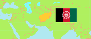
Ghaznī
Province in Afghanistan
Contents: Subdivision
The population in Ghaznī as well as related information and services (Wikipedia, Google, images).
| Name | Status | Native | Population Projection 2020-09-21 | |
|---|---|---|---|---|
| Ghaznī | Province | غزنی | 1,362,504 | |
| Āb Band | District | آببند | 31,089 | → |
| Ajristān | District | اجرستان | 32,550 | → |
| Andar | District | اندر | 140,963 | → |
| Deh Yak [Dih Yak] | District | دهیک | 55,269 | → |
| Ghaznī | Capital District | غزنی | 186,706 | → |
| Gīlān [Gelan] | District | گیلان | 65,366 | → |
| Gīrō | District | گیرو | 41,319 | → |
| Jaghatū | District | جغتو | 35,871 | → |
| Jaghūrī [Jaghori] | District | جاغوری | 199,553 | → |
| Khwājah 'Omarī [Khwaja Umari] | District | خواجهعمری | 21,390 | → |
| Malistān [Malestan] | District | مالستان | 92,736 | → |
| Muqur | District | مقر | 56,863 | → |
| Nāwah [Nawa] | District | ناوه | 33,613 | → |
| Nāwur | District | ناور | 106,952 | → |
| Qarah Bāgh [Qarabagh] | District | قرهباغ، | 161,424 | → |
| Rashīdān | District | رشیدان | 20,328 | → |
| Wāghaz | District | واغز | 43,578 | → |
| Walī Muḥammad Shahīd [Khūgyanī; Khogyani] | District | ولیمحمد شهید / خوگیانی | 22,719 | → |
| Zana Khān | District | زنهخان | 14,215 | → |
| Afghānestān [Afghanistan] | Islamic Republic | افغانستان | 32,890,200 |
Source: Central Statistics Office Afghanistan (web).
Explanation: The projection is based on the household listing performed from 2003 to 2005; the reliability of the figures is low. Nomades are only included in the total population of Afghanistan. Area figures of districts are computed by using geospatial data.