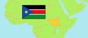
States
The population of the states of South Sudan according to census results and latest official projections.
Presidential decrees of 2015 and 2017 replace the ten states by 32 new states.
| Name | Abbr. | Capital | Area A (km²) | Population Census (C) 1983-02-01 | Population Census (C) 2008-04-22 | Population Projection (P) 2017-07-01 | |||
|---|---|---|---|---|---|---|---|---|---|
| South Sudan | SSD | Juba | 644,329 | 5,329,267 | 8,260,490 | 11,868,200 | |||
| Central Equatoria | CEQ | Juba | 43,033 | 565,442 | 1,103,557 | 1,574,700 | 4303300 | → | |
| Eastern Equatoria | EEQ | Kapoeta | 73,472 | 481,683 | 906,161 | 1,393,800 | 7347200 | → | |
| Jonglei | JON | Bor | 122,581 | 797,251 | 1,358,602 | 1,873,200 | 12258100 | → | |
| Lakes | LAK | Rumbek | 43,595 | 504,468 | 695,730 | 1,053,200 | 4359500 | → | |
| Northern Bahr el Ghazal | NBG | Aweil | 30,543 | 746,358 | 720,898 | 1,023,400 | 3054300 | → | |
| Unity | UNI | Bentiu | 37,837 | 311,042 | 585,801 | 877,300 | 3783700 | → | |
| Upper Nile | UNL | Malakal | 77,283 | 549,283 | 964,353 | 1,385,500 | 7728300 | → | |
| Warrap | WAR | Warrap | 45,566 | 794,231 | 972,928 | 1,380,000 | 4556600 | → | |
| Western Bahr el Ghazal | WBG | Wau | 91,076 | 220,453 | 333,431 | 473,600 | 9107600 | → | |
| Western Equatoria | WEQ | Yambio | 79,343 | 359,056 | 619,029 | 803,300 | 7934300 | → |
- The population projection does not consider migration and displacement since 2008.
- South Sudan National Bureau of Statistics (web).
Major Cities
| Name | Adm. | Population Census (C) 2008-04-22 | |
|---|---|---|---|
| 1 | Juba | CEQ | 230,195 |
| 2 | Wau | WBG | 118,331 |
| 3 | Malakal | UNL | 114,528 |
| 4 | Yambio | WEQ | 105,881 |
Contents: Cities & Towns
The population of major cities and towns in South Sudan by census years.
| Name | Adm. | Population Census (C) 1973-04-03 | Population Census (C) 1983-02-01 | Population Census (C) 2008-04-22 | Area | |
|---|---|---|---|---|---|---|
| Aweil | NBG | 17,773 | 25,714 | 59,217 | 0 | |
| Bentiu | UNI | ... | 5,188 | 41,328 | 0 | |
| Bor | JON | ... | 18,250 | 25,188 | 0 | |
| Juba | CEQ | 56,737 | 84,377 | 230,195 | 0 | |
| Kapoeta | EEQ | 5,332 | 5,344 | 16,449 | 0 | |
| Kodok | UNI | ... | ... | 4,103 | 0 | |
| Leer | UNI | ... | 7,109 | 17,827 | 0 | |
| Malakal | UNL | 34,894 | 33,737 | 114,528 | 0 | |
| Maridi | WEQ | 9,628 | 8,780 | 55,602 | 0 | |
| Renk | UNL | ... | 14,260 | 69,079 | 0 | |
| Rumbek | LAK | 17,748 | 19,399 | ... | 0 | |
| Tambura | WEQ | 8,778 | 5,854 | 12,008 | 0 | |
| Warrap | WAR | ... | ... | 5,769 | 0 | |
| Wau | WBG | 52,750 | 58,008 | 118,331 | 0 | |
| Yambio | WEQ | 6,675 | 24,927 | 105,881 | 0 | |
| Yei | CEQ | 11,932 | 23,418 | 69,720 | 0 | |
| Yirol | LAK | 14,663 | 7,042 | 12,707 | 0 |
- The 2008 figures are composed from population figures refering to payams and bolos. Thus, they may differ from the urban population of the corresponding places.
- (1973) (1983) provided by Clive Thornton.
(2008) South Sudan National Bureau of Statistics (web).
