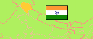
Dharmsāla is headquarter of the Tibetian government in exile.
State
The population development of the State of Himāchal Pradesh by census years.
| Name | Abbr. | Status | Capital | Area A (km²) | Population Census (Cf) 1981-03-01 | Population Census (Cf) 1991-03-01 | Population Census (Cf) 2001-03-01 | Population Census (Cf) 2011-03-01 | Population Projection (P) 2023-03-01 | |||
|---|---|---|---|---|---|---|---|---|---|---|---|---|
| India | IND | Rep | New Delhi | 3,166,620 | 685,184,692 | 846,387,888 | 1,028,737,436 | 1,210,854,977 | 1,387,284,900 | → | ||
| Himāchal Pradesh | HIM | St | Shimla | 55,673 | 4,280,818 | 5,170,877 | 6,077,900 | 6,864,602 | 7,468,000 | 5567300 | → |
- Office of the Registrar General and Census Commissioner.
(2023) National Commission on Population (adapted by Unique Identification Authority of India).
Contents: Agglomerations & Cities
The population development of all urban agglomerations and single cities in Himāchal Pradesh with more than 20,000 inhabitants by census years.
| Name | Status | Population Census (Cf) 1991-03-01 | Population Census (Cf) 2001-03-01 | Population Census (Cf) 2011-03-01 | Area | ||
|---|---|---|---|---|---|---|---|
| Baddi | CityOG | ... | 22,601 | 29,911 | 700 | → | |
| Chamba | City | 17,194 | 20,327 | 19,933 | 430 | → | |
| Dharmsāla (Dharamsala) | CityOG | 17,493 | 19,124 | 30,764 | 1060 | → | |
| Kullu | City | 14,569 | 18,306 | 18,536 | 670 | → | |
| Mandi | City | 23,202 | 26,873 | 26,422 | 430 | → | |
| Nāhan | City | 21,878 | 26,053 | 28,899 | 880 | → | |
| Pāonta Sāhib | City | 13,207 | 19,090 | 25,183 | 620 | → | |
| Shimla (Simla) | Aggl | 110,360 | 144,975 | 171,640 | 2990 | → | |
| Solan | City | 21,751 | 34,206 | 39,256 | 620 | → | |
| Sundarnagar | City | 20,397 | 23,986 | 24,344 | 1150 | → |
- (2001) (2011) Office of the Registrar General and Census Commissioner, Delimitation Commission of India, Population Census India.
